Informationssystem Stadt und Umwelt (ISU50) - Raumbezug 2015 (Umweltatlas) - [WFS]
Sachdaten des räumlichen Bezugssystems im Maßstab 1 : 50.000 für Daten des Umweltatlas aus statistischen Blöcken des regionalen Bezugssystems (RBS) mit Teilblöcken des Informationssystems Stadt und Umwelt (ISU), Stand 31.12.2015.
Dati un resursi
-
Serviceseite im FIS-Brokerhttp://publications.europa.eu/resource/authority/file-type/HTML
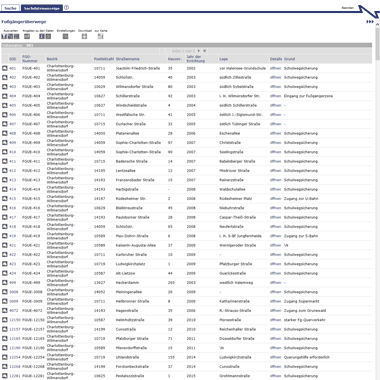
Aufruf des Geoportals Berlin mit Darstellung der downloadbaren Daten als...
-
Inhaltliche Beschreibunghttp://publications.europa.eu/resource/authority/file-type/HTML
Inhaltliche Beschreibung
-
Technische Beschreibunghttp://publications.europa.eu/resource/authority/file-type/PDF
Technische Beschreibung
-
Distribution für den Datenservice für...http://publications.europa.eu/resource/authority/file-type/XML
Papildus informācija
| Lauks | Vērtība |
|---|---|
| Avots | https://fbinter.stadt-berlin.de/fb?loginkey=alphaDataStart&alphaDataId=s_ISU50_2015_UA@senstadt |
| Versija | |
| Autors | |
| Autora epasts | |
| Uzturētājs | |
| Uzturētāja epasts | |
| Contact Point |
|
| Publisher |
|
| Creator | |
| Associated Datenservice | |
| Access Services Dataset | |
| Avots | https://fbinter.stadt-berlin.de/fb?loginkey=alphaDataStart&alphaDataId=s_ISU50_2015_UA@senstadt |
| Pēdējā atjaunināšana | jūlijs 23, 2025, 08:17 (CEST) |
| Izveidots | jūlijs 23, 2025, 08:06 (CEST) |
| conforms_to | ["http://dcat-ap.de/def/dcatde/3.0/"] |
| contributorID | ["http://dcat-ap.de/def/contributors/berlinOpenData", "http://dcat-ap.de/def/contributors/openNRW", "http://dcat-ap.de/def/contributors/openNRW"] |
| guid | https://datenregister.berlin.de/dataset/40bbbf4a-57d3-49e5-abeb-d5a8cfae3258 |
| harvest_object_id | 81ccce19-cc08-410a-aeab-161e3e70bf91 |
| harvest_source_id | d378a998-c0d1-4386-8d24-3bb3d37ac0e9 |
| harvest_source_title | berlin |
| identifier | c3a06ec6-a6c0-39fa-86f9-dae35931ddf4 |
| issued | 2024-02-02T10:07:47.735377 |
| language | ["http://publications.europa.eu/resource/authority/language/DEU"] |
| metadata_harvested_portal | https://datenregister.berlin.de/ |
| metadata_original_html | https://fbinter.stadt-berlin.de/fb?loginkey=alphaDataStart&alphaDataId=s_ISU50_2015_UA@senstadt |
| metadata_original_portal | https://www.opendata.sachsen.de/ |
| modified | 2024-02-02T10:07:47.735384 |
| non_open | true |
| opennrw_data_services_check | true |
| opennrw_dataprovider | Sachsen |
| opennrw_datapublisher | Senatsverwaltung für Stadtentwicklung, Bauen und Wohnen Berlin |
| opennrw_extras_counter | 1 |
| opennrw_geodata | false |
| opennrw_groups | [] |
| opennrw_openness_score | 3 |
| opennrw_spatial | Sachsen |
| original_tags | ["Berlin", "Blockkarte", "Bl\u00f6cke", "Daten", "Gebiet", "Gebiete", "Grundkarte", "Hintergrundkarte", "ISU", "LOR", "Lebensweltlich orientierte R\u00e4ume", "RBS", "Regionales Bezugssystem", "Sachdaten", "Statistisch", "Teilblockkarte", "Teilbl\u00f6cke", "Topografie", "Topographie", "Umweltatlas", "\u00dcbersichtskarte"] |
| politicalGeocodingLevelURI | http://dcat-ap.de/def/politicalGeocoding/Level/state |
| spatial | {"type": "Polygon", "coordinates": [[[13.079, 52.3284], [13.7701, 52.3284], [13.7701, 52.6877], [13.079, 52.6877], [13.079, 52.3284]]]} |
| spatial_uri | https://berlinonline.github.io/lod-berlin-lor/berlin |
| uri | https://datenregister.berlin.de/dataset/40bbbf4a-57d3-49e5-abeb-d5a8cfae3258 |
| conforms_to | ["http://dcat-ap.de/def/dcatde/3.0/"] |
| contributorID | ["http://dcat-ap.de/def/contributors/berlinOpenData", "http://dcat-ap.de/def/contributors/openNRW", "http://dcat-ap.de/def/contributors/openNRW"] |
| guid | https://datenregister.berlin.de/dataset/40bbbf4a-57d3-49e5-abeb-d5a8cfae3258 |
| identifier | c3a06ec6-a6c0-39fa-86f9-dae35931ddf4 |
| issued | 2024-02-02T10:07:47.735377 |
| language | ["http://publications.europa.eu/resource/authority/language/DEU"] |
| metadata_harvested_portal | https://datenregister.berlin.de/ |
| metadata_original_html | https://fbinter.stadt-berlin.de/fb?loginkey=alphaDataStart&alphaDataId=s_ISU50_2015_UA@senstadt |
| metadata_original_portal | https://www.opendata.sachsen.de/ |
| modified | 2024-02-02T10:07:47.735384 |
| non_open | true |
| opennrw_data_services_check | true |
| opennrw_dataprovider | Sachsen |
| opennrw_datapublisher | Senatsverwaltung für Stadtentwicklung, Bauen und Wohnen Berlin |
| opennrw_extras_counter | 1 |
| opennrw_geodata | false |
| opennrw_groups | [] |
| opennrw_openness_score | 3 |
| opennrw_spatial | Sachsen |
| original_tags | ["Berlin", "Blockkarte", "Bl\u00f6cke", "Daten", "Gebiet", "Gebiete", "Grundkarte", "Hintergrundkarte", "ISU", "LOR", "Lebensweltlich orientierte R\u00e4ume", "RBS", "Regionales Bezugssystem", "Sachdaten", "Statistisch", "Teilblockkarte", "Teilbl\u00f6cke", "Topografie", "Topographie", "Umweltatlas", "\u00dcbersichtskarte"] |
| politicalGeocodingLevelURI | http://dcat-ap.de/def/politicalGeocoding/Level/state |
| spatial | {"type": "Polygon", "coordinates": [[[13.079, 52.3284], [13.7701, 52.3284], [13.7701, 52.6877], [13.079, 52.6877], [13.079, 52.3284]]]} |
| spatial_uri | https://berlinonline.github.io/lod-berlin-lor/berlin |
| uri | https://datenregister.berlin.de/dataset/40bbbf4a-57d3-49e5-abeb-d5a8cfae3258 |
| harvest_object_id | 81ccce19-cc08-410a-aeab-161e3e70bf91 |
| harvest_source_id | d378a998-c0d1-4386-8d24-3bb3d37ac0e9 |
| harvest_source_title | berlin |